 Geodatensuche Berlin
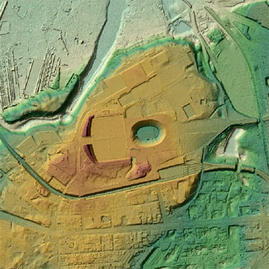
ATKIS® DGM - Digitales Geländemodell -
Das ATKIS DGM ist ein Teil des Amtlichen Topographisch-Kartographischen Informationssystem (ATKIS). Das DGM beschreibt höhenmäßig die Erdoberfläche ohne natürliche (z. B. Vegetation) und künstliche Objekte (z. B. Bauwerke). Das DGM liegt in Form eines gleichmäßigen Rasters mit einer Rasterweite von 1m im Blattschnitt 2km x 2km vor. In das Land Brandenburg reicht ein Buffer von ca. 250m.
Simple
- Date (Creation)
- 2021-07-13
- Date (Publication)
- 2026-01-29
- Date (Revision)
- 2025-12-18
- Identifier
- https://registry.gdi-de.org/id/de.be.csw/a98210d0-8e08-3112-89f9-44d945ba69b3
- Maintenance and update frequency
- As needed
- Theme
-
-
inspireidentifiziert
-
open data
-
opendata
-
Sachdaten
-
Karten
-
Geodaten
-
Berlin
-
AdVMIS
-
DGM
-
ATKIS
-
Topographie
-
Topografie
-
topographisch
-
Höhenmodell
-
Höhenmodelle
-
Höhenlinien
-
Geländemodell
-
Geländemodelle
-
Gelände
-
topografisch
-
-
GEMET - INSPIRE themes, version 1.0
-
-
Höhe
-
- Access constraints
- Other restrictions
- Other constraints
- Es gelten keine Zugriffsbeschränkungen
- Use constraints
- Other restrictions
- Other constraints
-
Für die Nutzung der Daten ist die Datenlizenz Deutschland - Zero - Version 2.0 anzuwenden. Die Lizenz ist über https://www.govdata.de/dl-de/zero-2-0 abrufbar.
- Other constraints
-
{"id":"dl-zero-de/2.0","name":"Datenlizenz Deutschland - Zero - Version 2.0","url":" https://www.govdata.de/dl-de/zero-2-0"}
- Spatial representation type
- Grid
- Distance
- 1.0 metres
- Metadata language
- Deutsch
- Character set
- UTF8
- Topic category
-
- Elevation
))
- Extent type code
- Yes
- Geographic identifier
- 110000000000
- Reference system identifier
- http://www.opengis.net/def/crs/EPSG/0/25833
- Distribution format
-
-
Text/HTML
(
4.01
)
- Specification
-
Keine Angabe
-
Text/HTML
(
4.01
)
- OnLine resource
- Downloaddienst - ATKIS® DGM (1m-Rasterweite) (ATOM) ( INSPIRE ATOM )
- OnLine resource
- Darstellungsdienst - ATKIS® DGM - Digitales Geländemodell - (WMS) ( Darstellungsdienst - ATKIS® DGM - Digitales Geländemodell - (WMS) )
- OnLine resource
- Inhaltliche Beschreibung
- OnLine resource
- Digitale Geländemodelle – ATKIS DGM
- Hierarchy level
- Dataset
Conformance result
- Date (Publication)
- 2010-12-08
- Explanation
-
see referenced specification
- Pass
- No
- Statement
-
Airborne Laserscanning Flug 24.02.2021, 25.02.2021 und 02.03.2021; Aktualisierung mittels stereoskopischer Auswertung des Bildflugs 03/2022, 04/2023, 03/2025 und 08/2025
- Description
-
Airborne Laserscanning Flug 24.02.2021, 25.02.2021 und 02.03.2021; Aktualisierung mittels stereoskopischer Auswertung des Bildflugs 03/2022, 04/2023, 03/2025 und 08/2025
- File identifier
- f0e8ff09-2887-3446-9c53-81dbc45af03c XML
- Metadata language
- Deutsch
- Character set
- UTF8
- Hierarchy level
- Dataset
- Date stamp
- 2026-04-21T06:51:47.022271856Z
- Metadata standard name
-
ISO 19115/19119 - BE
- Metadata standard version
-
1.0.0
Overviews
Spatial extent
Provided by
