 Geodatensuche Berlin
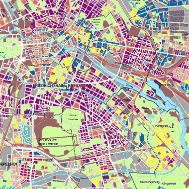
Stadtstruktur (Umweltatlas) - ab 2021
Stadtstruktur auf Grundlage der Blockkarte 1 : 5.000 (ISU5, Raumbezug Umweltatlas Fortschreibung ab 2021).
Simple
- Date (Publication)
- 2024-10-28
- Identifier
- https://registry.gdi-de.org/id/de.be.csw/65e9ffb4-1c2f-38d1-845f-d20c610c9c2a
- Maintenance and update frequency
- Not planned
- Theme
-
-
open data
-
opendata
-
Karten
-
Sachdaten
-
Geodaten
-
Berlin
-
Umweltatlas
-
Baunutzung
-
Bebauung
-
reale Flächennutzung
-
Wohngebiete
-
Mischgebiete
-
Kerngebiete
-
Gewerbegebiete
-
Wohnflächen
-
Industriegebiete
-
Gemeinbedarf
-
Ver- und Entsorgung
-
Wochenendhausgebiete
-
Baustellen
-
Grünflächen
-
Freiflächen
-
Parkanlagen
-
Wälder
-
Sportflächen
-
Kleingartenanlagen
-
unbebaute Flächen
-
Friedhöfe
-
Brachflächen
-
Campingplätze
-
Sportanlagen
-
Baumschulen
-
Stadtstruktur
-
Baualter
-
Baustruktur
-
Freiraumstruktur
-
Baustrukturtypen
-
Luftbildauswertung
-
Satellitenbildauswertung
-
Versiegelung
-
Belagsart
-
- Access constraints
- Other restrictions
- Other constraints
- Es gelten keine Zugriffsbeschränkungen
- Use constraints
- Other restrictions
- Other constraints
-
Für die Nutzung der Daten ist die Datenlizenz Deutschland - Zero - Version 2.0 anzuwenden. Die Lizenz ist über https://www.govdata.de/dl-de/zero-2-0 abrufbar.
- Other constraints
-
{"id":"dl-zero-de/2.0","name":"Datenlizenz Deutschland - Zero - Version 2.0","url":" https://www.govdata.de/dl-de/zero-2-0"}
- Spatial representation type
- Text, table
- Denominator
- 50000
- Metadata language
- Deutsch
- Character set
- UTF8
- Topic category
-
- Planning cadastre
))
- Extent type code
- Yes
- Geographic identifier
- 110000000000
- Reference system identifier
- http://www.opengis.net/def/crs/EPSG/0/25833
- Distribution format
-
-
Text/HTML
(
4.01
)
- Specification
-
Keine Angabe
-
Text/HTML
(
4.01
)
- OnLine resource
- Darstellungsdienst - Stadtstruktur (Umweltatlas) - ab 2021 (WMS) ( Darstellungsdienst - Stadtstruktur (Umweltatlas) - ab 2021 (WMS) )
- OnLine resource
- Downloaddienst - Stadtstruktur (Umweltatlas) - ab 2021 (WFS) ( Downloaddienst - Stadtstruktur (Umweltatlas) - ab 2021 (WFS) )
- OnLine resource
- Inhaltliche Beschreibung
- OnLine resource
- Technische Beschreibung
- OnLine resource
- Dokumentation Nutzungs- und Stadtstrukturkartierung
- OnLine resource
- Umweltatlas, Karten 06.01, 06.01.1, 06.02, 06.02.1
- OnLine resource
- Umweltatlas, Karten 06.07 und 06.08
- Hierarchy level
- Dataset
- Statement
-
Stadtstruktur 2023 (Umweltatlas): Blockkarte des Informationssystems Stadt und Umwelt (ISU5), Stand 31.12.2022, Straßenflächen des Informationssystems Stadt und Umwelt (ISU5), Stand 31.12.2022., Amtliches Liegenschaftskatasterinformationssystem ? ALKIS (Geoportal Berlin), Stand 03.2024, Bodengesellschaften des Informationssystems Stadt und Umwelt (ISU5), Stand 13.08.2018, Digitale Orthophotos (Geoportal Berlin), Befliegungen 2020 (1., 8., 12. und 16. August), 2022 (1., 8. und 9. März) und 2023 (22. April), 2024 (08. und 26. März), Gebäudealter der Wohnbebauung (Umweltatlas), Stand 31.12.2015, Gesammelte Merkposten seit der letzten Fortschreibung, Stand 12.2024, Grünanlagen- und Spielplatzbestand (Geoportal Berlin), Stand 02.2024, Karte von Berlin 1:5.000 (K5) (Geoportal Berlin), Stand 01.2024, Moorgebiete und Bodentypen (Umweltatlas), Stand 05.2015, Straßenbefahrung 2014 (Geoportal Berlin), Stand 31.12.2015, Übergeordnetes Straßennetz, Stand 10.2023., Wohnbauflächen-Informationssystem (WoFIS), SenStadtWohn Berlin, Stand 12.2023., Baufertigstellungen, Amt für Statistik Berlin-Brandenburg (AfS), Stand 12.2023, Statistische Blöcke, Amt für Statistik Berlin-Brandenburg (AfS), Stand 12.2024, Digitales Feldblockkataster, Landwirtschaftliche Referenzparzellen, Ministerium für Ländliche Entwicklung, Umwelt und Landwirtschaft Brandenburg, Stand 22.04.2023., Stadtstruktur 2022 (Umweltatlas): Blockkarte des Informationssystems Stadt und Umwelt (ISU5), Stand 31.12.2021, Straßenflächen des Informationssystems Stadt und Umwelt (ISU5), Stand 31.12.2021., Amtliches Liegenschaftskatasterinformationssystem - ALKIS (Geoportal Berlin), Stand 01.09.2023, Amtliches Topographisch-Kartographisches Informationssystem - ATKIS (Geoportal Berlin), Stand 04.08.2023, Bodengesellschaften des Informationssystems Stadt und Umwelt (ISU5), Stand 13.08.2018, Digitale Orthophotos (Geoportal Berlin), Befliegungen 2020 (1., 8., 12. und 16. August), 2022 (1., 8. und 9. März) und 2023 (22. April), Gebäudealter der Wohnbebauung (Umweltatlas), Stand 31.12.2015, Gesammelte Merkposten seit der letzten Fortschreibung, Stand 08.2023, Grünanlagen- und Spielplatzbestand (Geoportal Berlin), Stand 01.03.2023, Karte von Berlin 1:5.000 (K5) (Geoportal Berlin), Stand 02.01.2023, Kleingartenbestand (Geoportal Berlin), Stand 08.11.2022, Moorgebiete und Bodentypen (Umweltatlas), Stand 05.2015, Straßenbefahrung 2014 (Geoportal Berlin), Stand 31.12.2015, Übergeordnetes Straßennetz, Stand 10.2023., Wohnbauflächen-Informationssystem (WoFIS), SenStadtWohn Berlin, Stand 12.2022., Baufertigstellungen 2022, Amt für Statistik Berlin-Brandenburg (AfS), Stand 12.2022, Statistische Blöcke, Amt für Statistik Berlin-Brandenburg (AfS), Stand 02.2023, Digitales Feldblockkataster, Landwirtschaftliche Referenzparzellen, Ministerium für Ländliche Entwick-lung, Umwelt und Landwirtschaft Brandenburg, Stand 22.04.2023., Stadtstruktur 2021 (Umweltatlas): Blockkarte des Informationssystems Stadt und Umwelt (ISU5), Stand 31.12.2020, Straßenflächen des Informationssystems Stadt und Umwelt (ISU5), Stand 06.2021., Daten der Senatsverwaltungen für Stadtentwicklung, Bauen und Wohnen sowie Umwelt, Amtliches Liegenschaftskatasterinformationssystem - ALKIS (Geoportal Berlin), Stand 04.11.2022, Amtliches Topographisch-Kartographisches Informationssystem - ATKIS (Geoportal Berlin), Stand 05.11.2022, Bodengesellschaften des Informationssystems Stadt und Umwelt (ISU5), Stand 13.08.2018, Digitale Orthophotos (Geoportal Berlin), Befliegungen 2020 (1., 8., 12. und 16. August) und 2022 (1., 8. und 9. März), Gebäudealter der Wohnbebauung (Umweltatlas), Stand 31.12.2015, Gesammelte Merkposten seit der letzten Fortschreibung, Stand 06.2022, Grünanlagen- und Spielplatzbestand (Geoportal Berlin), Stand 10.02.2022, Karte von Berlin 1:5.000 (K5) (Geoportal Berlin), Stand 01.01.2022, Moorgebiete und Bodentypen (Umweltatlas), Stand 05.2015, Straßenbefahrung 2014 (Geoportal Berlin), Stand 31.12.2015, Übergeordnetes Straßennetz, Stand 11.2022., Wohnbauflächen-Informationssystem (WoFIS), SenStadtWohn Berlin, Stand 12.2021., Bauabgangsdaten, Amt für Statistik Berlin-Brandenburg, Stand 12.2021, Baufertigstellungen 2021, Amt für Statistik Berlin-Brandenburg (AfS), Stand 12.2021, Gewerbeflächen-Informationssystem (GeFIS), Stand 2022, Statistische Blöcke, Amt für Statistik Berlin-Brandenburg (AfS), Stand 03.01.2022, Digitales Feldblockkataster, Landwirtschaftliche Referenzparzellen, Ministerium für Ländliche Entwicklung, Umwelt und Landwirtschaft Brandenburg, Stand 06.2022.
- Description
-
Stadtstruktur 2023 (Umweltatlas): Blockkarte des Informationssystems Stadt und Umwelt (ISU5), Stand 31.12.2022
- Description
-
Straßenflächen des Informationssystems Stadt und Umwelt (ISU5), Stand 31.12.2022.
- Description
-
Amtliches Liegenschaftskatasterinformationssystem ? ALKIS (Geoportal Berlin), Stand 03.2024
- Description
-
Bodengesellschaften des Informationssystems Stadt und Umwelt (ISU5), Stand 13.08.2018
- Description
-
Digitale Orthophotos (Geoportal Berlin), Befliegungen 2020 (1., 8., 12. und 16. August), 2022 (1., 8. und 9. März) und 2023 (22. April), 2024 (08. und 26. März)
- Description
-
Gebäudealter der Wohnbebauung (Umweltatlas), Stand 31.12.2015
- Description
-
Gesammelte Merkposten seit der letzten Fortschreibung, Stand 12.2024
- Description
-
Grünanlagen- und Spielplatzbestand (Geoportal Berlin), Stand 02.2024
- Description
-
Karte von Berlin 1:5.000 (K5) (Geoportal Berlin), Stand 01.2024
- Description
-
Moorgebiete und Bodentypen (Umweltatlas), Stand 05.2015
- Description
-
Straßenbefahrung 2014 (Geoportal Berlin), Stand 31.12.2015
- Description
-
Übergeordnetes Straßennetz, Stand 10.2023.
- Description
-
Wohnbauflächen-Informationssystem (WoFIS), SenStadtWohn Berlin, Stand 12.2023.
- Description
-
Baufertigstellungen, Amt für Statistik Berlin-Brandenburg (AfS), Stand 12.2023
- Description
-
Statistische Blöcke, Amt für Statistik Berlin-Brandenburg (AfS), Stand 12.2024
- Description
-
Digitales Feldblockkataster, Landwirtschaftliche Referenzparzellen, Ministerium für Ländliche Entwicklung, Umwelt und Landwirtschaft Brandenburg, Stand 22.04.2023.
- Description
-
Stadtstruktur 2022 (Umweltatlas): Blockkarte des Informationssystems Stadt und Umwelt (ISU5), Stand 31.12.2021
- Description
-
Straßenflächen des Informationssystems Stadt und Umwelt (ISU5), Stand 31.12.2021.
- Description
-
Amtliches Liegenschaftskatasterinformationssystem - ALKIS (Geoportal Berlin), Stand 01.09.2023
- Description
-
Amtliches Topographisch-Kartographisches Informationssystem - ATKIS (Geoportal Berlin), Stand 04.08.2023
- Description
-
Bodengesellschaften des Informationssystems Stadt und Umwelt (ISU5), Stand 13.08.2018
- Description
-
Digitale Orthophotos (Geoportal Berlin), Befliegungen 2020 (1., 8., 12. und 16. August), 2022 (1., 8. und 9. März) und 2023 (22. April)
- Description
-
Gebäudealter der Wohnbebauung (Umweltatlas), Stand 31.12.2015
- Description
-
Gesammelte Merkposten seit der letzten Fortschreibung, Stand 08.2023
- Description
-
Grünanlagen- und Spielplatzbestand (Geoportal Berlin), Stand 01.03.2023
- Description
-
Karte von Berlin 1:5.000 (K5) (Geoportal Berlin), Stand 02.01.2023
- Description
-
Kleingartenbestand (Geoportal Berlin), Stand 08.11.2022
- Description
-
Moorgebiete und Bodentypen (Umweltatlas), Stand 05.2015
- Description
-
Straßenbefahrung 2014 (Geoportal Berlin), Stand 31.12.2015
- Description
-
Übergeordnetes Straßennetz, Stand 10.2023.
- Description
-
Wohnbauflächen-Informationssystem (WoFIS), SenStadtWohn Berlin, Stand 12.2022.
- Description
-
Baufertigstellungen 2022, Amt für Statistik Berlin-Brandenburg (AfS), Stand 12.2022
- Description
-
Statistische Blöcke, Amt für Statistik Berlin-Brandenburg (AfS), Stand 02.2023
- Description
-
Digitales Feldblockkataster, Landwirtschaftliche Referenzparzellen, Ministerium für Ländliche Entwick-lung, Umwelt und Landwirtschaft Brandenburg, Stand 22.04.2023.
- Description
-
Stadtstruktur 2021 (Umweltatlas): Blockkarte des Informationssystems Stadt und Umwelt (ISU5), Stand 31.12.2020
- Description
-
Straßenflächen des Informationssystems Stadt und Umwelt (ISU5), Stand 06.2021.
- Description
-
Daten der Senatsverwaltungen für Stadtentwicklung, Bauen und Wohnen sowie Umwelt
- Description
-
Amtliches Liegenschaftskatasterinformationssystem - ALKIS (Geoportal Berlin), Stand 04.11.2022
- Description
-
Amtliches Topographisch-Kartographisches Informationssystem - ATKIS (Geoportal Berlin), Stand 05.11.2022
- Description
-
Bodengesellschaften des Informationssystems Stadt und Umwelt (ISU5), Stand 13.08.2018
- Description
-
Digitale Orthophotos (Geoportal Berlin), Befliegungen 2020 (1., 8., 12. und 16. August) und 2022 (1., 8. und 9. März)
- Description
-
Gebäudealter der Wohnbebauung (Umweltatlas), Stand 31.12.2015
- Description
-
Gesammelte Merkposten seit der letzten Fortschreibung, Stand 06.2022
- Description
-
Grünanlagen- und Spielplatzbestand (Geoportal Berlin), Stand 10.02.2022
- Description
-
Karte von Berlin 1:5.000 (K5) (Geoportal Berlin), Stand 01.01.2022
- Description
-
Moorgebiete und Bodentypen (Umweltatlas), Stand 05.2015
- Description
-
Straßenbefahrung 2014 (Geoportal Berlin), Stand 31.12.2015
- Description
-
Übergeordnetes Straßennetz, Stand 11.2022.
- Description
-
Wohnbauflächen-Informationssystem (WoFIS), SenStadtWohn Berlin, Stand 12.2021.
- Description
-
Bauabgangsdaten, Amt für Statistik Berlin-Brandenburg, Stand 12.2021
- Description
-
Baufertigstellungen 2021, Amt für Statistik Berlin-Brandenburg (AfS), Stand 12.2021
- Description
-
Gewerbeflächen-Informationssystem (GeFIS), Stand 2022
- Description
-
Statistische Blöcke, Amt für Statistik Berlin-Brandenburg (AfS), Stand 03.01.2022
- Description
-
Digitales Feldblockkataster, Landwirtschaftliche Referenzparzellen, Ministerium für Ländliche Entwicklung, Umwelt und Landwirtschaft Brandenburg, Stand 06.2022.
- File identifier
- e851750b-164c-4cf3-af4d-ba1e7c168484 XML
- Metadata language
- Deutsch
- Character set
- UTF8
- Hierarchy level
- Dataset
- Date stamp
- 2025-12-04T12:30:33.050544568Z
- Metadata standard name
-
ISO 19115/19119 - BE
- Metadata standard version
-
1.0.0
Overviews
Spatial extent
Provided by
