 Geodatensuche Berlin
Einwohnerdichte 2021 (Umweltatlas)
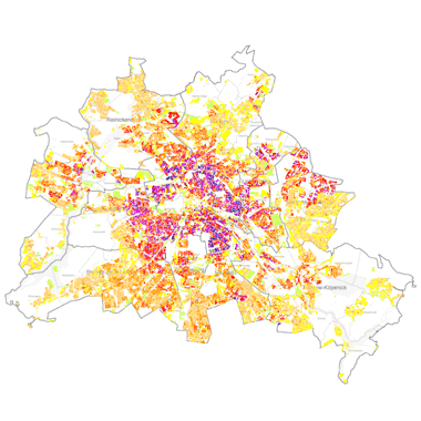
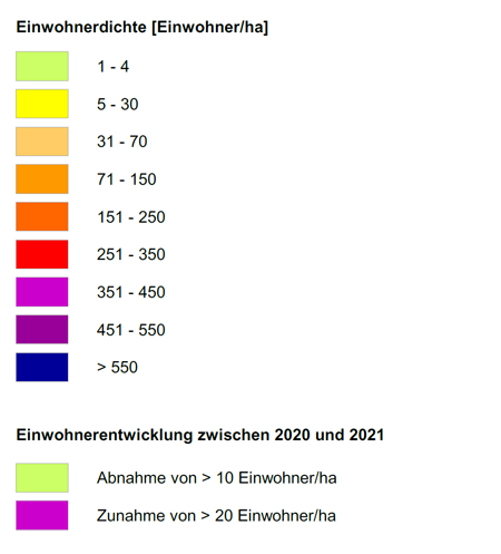
Einwohnerdichte [Einwohner/ha] und Veränderung der Einwohnerdichte [Einwohner/ha] von 2021 gegenüber 2020 auf Ebene der Block- und Blockteilflächen der Karte 1 : 5.000 (ISU5, Raumbezug Umweltatlas 2020).
Simple
Identification info
- Date (Publication)
- 2022-05-04
- Identifier
- https://registry.gdi-de.org/id/de.be.csw/a1cce4a0-9c2e-31d5-8fac-78058d519008
- Presentation form
- Digital map
- Maintenance and update frequency
- Not planned
- Theme
-
-
open data
-
opendata
-
Karten
-
Sachdaten
-
Geodaten
-
Berlin
-
Bevölkerungsdichte
-
Einwohner
-
Dichte
-
Block
-
Blockteilfläche
-
Amt für Statistik
-
AfS
-
Bevölkerungsentwicklung
-
Umweltatlas
-
Bewohner
-
- Keywords
-
-
infoMapAccessService
-
- Access constraints
- Other restrictions
- Other constraints
- Es gelten keine Zugriffsbeschränkungen
- Use constraints
- Other restrictions
- Other constraints
-
Der Datenbestand wird unter der Lizenz CC-BY-3.0-Namensnennung veröffentlicht (vgl. https://creativecommons.org/licenses/by/3.0/de/). Der Quellenvermerk gemäß Abschnitt 3a der Lizenz lautet "Amt für Statistik Berlin-Brandenburg / Einwohnerdichte 2021 (Umweltatlas)".
- Other constraints
-
{"id":"cc-by-de/3.0","name":"Creative Commons - Namensnennung 3.0 Deutschland","url":" https://creativecommons.org/licenses/by/3.0/de/","quelle":"Amt für Statistik Berlin-Brandenburg / Einwohnerdichte 2021 (Umweltatlas)"}
- Service Type
- view
- Service Version
-
OGC:WMS 1.0.0
- Service Version
-
OGC:WMS 1.1.0
- Service Version
-
OGC:WMS 1.1.1
- Service Version
-
OGC:WMS 1.3.0
))
- Extent type code
- Yes
- Geographic identifier
- 110000000000
- Coupling Type
- Tight
Contains Operations
- Operation Name
-
GetCapabilities
- Distributed Computing Platforms
- Web services
- Operates On
- Reference system identifier
- http://www.opengis.net/def/crs/EPSG/0/25833
- Distribution format
-
-
Text/HTML
(
4.01
)
- Specification
-
Keine Angabe
-
Text/HTML
(
4.01
)
- OnLine resource
- Darstellungsdienst - Einwohnerdichte 2021 (Umweltatlas) (WMS) ( Darstellungsdienst - Einwohnerdichte 2021 (Umweltatlas) (WMS) )
- OnLine resource
- Darstellung der Karte im Geoportal Berlin
- Hierarchy level
- Service
- Other
-
Dienst
- File identifier
- da03c0f6-a0df-33e8-9f88-f7b8f704475e XML
- Metadata language
- Deutsch
- Character set
- UTF8
- Hierarchy level
- Service
- Hierarchy level name
-
Einwohnerdichte 2021 (Umweltatlas) Dienst
- Date stamp
- 2026-08-04T11:21:34.094677347Z
- Metadata standard name
-
ISO 19115/19119 - BE
- Metadata standard version
-
1.0.0
Overviews
Spatial extent
Provided by
