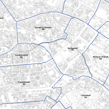
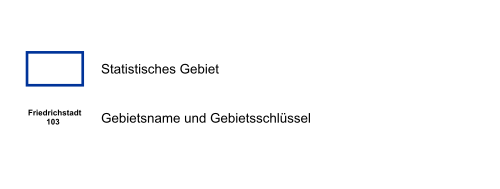
Statistische Gebiete des Regionalen Bezugssytems (RBS)
Der Datenbestand enthält die Geometrien der 195 statistischen Gebiete des Regionalen Bezugssytems (RBS) als Grundlage für statistische Auswertungen. Es handelt sich hierbei um einen historischen Datensatz.
Simple
Identification info
- Date (Creation)
- 2021-12-31
- Date (Publication)
- 2023-11-13
- Date (Revision)
- 2023-11-06
- Identifier
- https://registry.gdi-de.org/id/de.be.csw/c7042b8d-0c99-32e3-aef2-b8349081ffbb
- Presentation form
- Digital map
- Maintenance and update frequency
- As needed
- Theme
-
-
open data
-
opendata
-
Geodaten
-
Berlin
-
RBS
-
Amt für Statistik Berlin Brandenburg
-
Regionales Bezugssystem Berlin
-
AfS
-
Statistisches Gebiet
-
- Access constraints
- Other restrictions
- Other constraints
- Es gelten keine Zugriffsbeschränkungen
- Use constraints
- Other restrictions
- Other constraints
-
Der Datenbestand wird unter der Lizenz CC-BY-3.0-Namensnennung veröffentlicht (vgl. https://creativecommons.org/licenses/by/3.0/de/). Als Urheber ist dabei zu nennen: Amt für Statistik Berlin-Brandenburg 2023
- Other constraints
-
{"id": "CC BY 3.0 DE" , "name": "Creative Commons - Namensnennung 3.0 Deutschland", "url": " https://creativecommons.org/licenses/by/3.0/de/", "quelle": "Amt für Statistik Berlin-Brandenburg 2023" }
- Service Type
- view
- Service Version
-
OGC:WMS 1.0.0
- Service Version
-
OGC:WMS 1.1.0
- Service Version
-
OGC:WMS 1.1.1
- Service Version
-
OGC:WMS 1.3.0
))
- Extent type code
- Yes
- Geographic identifier
- 110000000000
- Coupling Type
- Tight
Contains Operations
- Operation Name
-
GetCapabilities
- Distributed Computing Platforms
- Web services
- Reference system identifier
- http://www.opengis.net/def/crs/EPSG/0/25833
- Distribution format
-
-
Text/HTML
(
4.01
)
-
Text/HTML
(
4.01
)
- OnLine resource
- GetCapabilities Aufruf des WMS mit maschinenlesbarer Antwort
- OnLine resource
- Inhaltliche Beschreibung
- OnLine resource
- Technische Beschreibung
- Hierarchy level
- Service
- Other
-
Dienst
- File identifier
- b6f9d8f1-5984-3e5a-91eb-416ebeb4aeb4 XML
- Metadata language
- Deutsch
- Character set
- UTF8
- Hierarchy level
- Service
- Hierarchy level name
-
Statistische Gebiete des Regionalen Bezugssytems (RBS) Dienst
- Date stamp
- 2024-09-10T11:31:20
- Metadata standard name
-
ISO 19115/19119 – BE
- Metadata standard version
-
1.0.0
Overviews


Spatial extent
))
Provided by

 Geodatensuche