 Geodatensuche Berlin
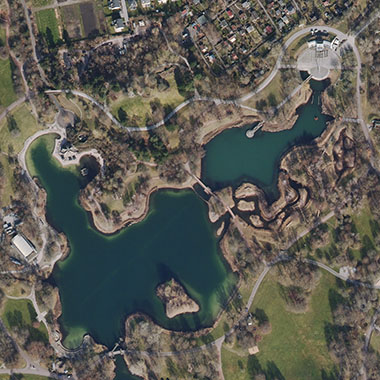
Digitale farbige Orthophotos 2025 (DOP20RGBI)
Bei den Daten handelt es sich um farbige digitale Orthophotomosaike (DOP). Daten liegen für das gesamte Berliner Stadtgebiet im Blattschnitt 2 km x 2 km vor und haben eine Bodenauflösung von 0,20 m bei einer Lagegenauigkeit von +/- 0,4 m.
Simple
- Date (Creation)
- 2025-03-04
- Date (Publication)
- 2025-06-19
- Identifier
- https://registry.gdi-de.org/id/de.be.csw/b95b0e00-7341-3724-bf32-5a0bec69aeee
- Maintenance and update frequency
- As needed
- Theme
-
-
open data
-
opendata
-
Sachdaten
-
Karten
-
Geodaten
-
Berlin
-
AdVMIS
-
Luftbilder
-
Orthophotos
-
DOP
-
Topographie
-
Topografie
-
topographisch
-
topografisch
-
- Access constraints
- Other restrictions
- Other constraints
- Es gelten keine Zugriffsbeschränkungen
- Use constraints
- Other restrictions
- Other constraints
-
Für die Nutzung der Daten ist die Datenlizenz Deutschland - Zero - Version 2.0 anzuwenden. Die Lizenz ist über https://www.govdata.de/dl-de/zero-2-0 abrufbar.
- Other constraints
-
{"id":"dl-zero-de/2.0","name":"Datenlizenz Deutschland - Zero - Version 2.0","url":" https://www.govdata.de/dl-de/zero-2-0"}
- Spatial representation type
- Grid
- Distance
- 2.0 metres
- Metadata language
- Deutsch
- Character set
- UTF8
- Topic category
-
- Imagery base maps earth cover
))
- Extent type code
- Yes
- Geographic identifier
- 110000000000
- Reference system identifier
- http://www.opengis.net/def/crs/EPSG/0/25833
- Distribution format
-
-
Text/HTML
(
4.01
)
- Specification
-
Keine Angabe
-
Text/HTML
(
4.01
)
- OnLine resource
- Downloaddienst - Digitale farbige Orthophotos 2025 (DOP20RGBI) (ATOM) ( INSPIRE ATOM )
- OnLine resource
- Darstellungsdienst - Digitale farbige Orthophotos 2025 (DOP20RGBI) (WMS) ( Darstellungsdienst - Digitale farbige Orthophotos 2025 (DOP20RGBI) (WMS) )
- OnLine resource
- Darstellung der Daten im Geoportal Berlin
- OnLine resource
- Senatsverwaltung für Stadtentwicklung, Bauen und Wohnen
- Hierarchy level
- Dataset
- Statement
-
Bildflug vom 24. März 2025, Bildflug vom 24.04.2025
- Description
-
Bildflug vom 24. März 2025
- Description
-
Bildflug vom 24.04.2025
- File identifier
- 73a3de47-ab2a-4be2-ae5d-8d6f8fe5cc1c XML
- Metadata language
- Deutsch
- Character set
- UTF8
- Hierarchy level
- Dataset
- Date stamp
- 2026-05-04T09:36:18.946155387Z
- Metadata standard name
-
ISO 19115/19119 - BE
- Metadata standard version
-
1.0.0
Overviews
Spatial extent
Provided by
