 Geodatensuche Berlin
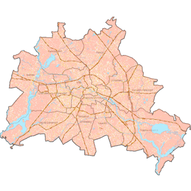
Informationssystem Stadt und Umwelt (ISU5) - Raumbezug - ab 2021
Räumliche Bezugsgeometrie des Informationssystems Stadt und Umwelt (ISU). Die abgegrenzten ISU5-Flächen stehen in einem engen Bezug zu den "Statistischen Blöcken des RBS", unterscheiden sich jedoch in der Blockabgrenzung zum Straßenland, in der Bildung von Raumeinheiten unterhalb der Blockebene, den sogenannten Blockteilflächen, sowie von Straßenflächen.
Der Raumbezug des Informationssystems Stadt und Umwelt (im Folgenden ISU5) wird als Schwerpunktaktualisierung jährlich fortgeschrieben. Dabei werden die statistischen Blöcke sowie Nutzungsänderungen aufgrund von baulichen Veränderungen aktualisiert.
Die 5-jährlichen Fortschreibung, in der eine größere Auswahl an Geo-Fachdatensätzen zur Prüfung der realen Flächennutzung herangezogen wird, finden Sie unter "Informationssystem Stadt und Umwelt (ISU5) - Raumbezug 2020".
Simple
- Date (Creation)
- 2022-03-01
- Date (Publication)
- 2026-01-06
- Date (Revision)
- 2026-01-06
- Identifier
- https://registry.gdi-de.org/id/de.be.csw/37dc765d-23e9-346a-944c-ef64cfe3ade7
- Maintenance and update frequency
- As needed
- Theme
-
-
open data
-
opendata
-
Karten
-
Sachdaten
-
Geodaten
-
Berlin
-
Regionales Bezugssystem
-
RBS
-
Statistische Gebiete
-
Topografie
-
Topographie
-
Übersichtskarte
-
Hintergrundkarte
-
Grundkarte
-
Umweltatlas
-
Blöcke
-
Blockkarte
-
Teilblöcke
-
Teilblockkarte
-
ISU
-
Berliner Bezirke
-
Bezirksgrenzen
-
- Access constraints
- Other restrictions
- Other constraints
- Es gelten keine Zugriffsbeschränkungen
- Use constraints
- Other restrictions
- Other constraints
-
Für die Nutzung der Daten ist die Datenlizenz Deutschland - Zero - Version 2.0 anzuwenden. Die Lizenz ist über https://www.govdata.de/dl-de/zero-2-0 abrufbar.
- Other constraints
-
{"id":"dl-zero-de/2.0","name":"Datenlizenz Deutschland - Zero - Version 2.0","url":" https://www.govdata.de/dl-de/zero-2-0"}
- Spatial representation type
- Vector
- Denominator
- 5000
- Metadata language
- Deutsch
- Character set
- UTF8
- Topic category
-
- Boundaries
))
- Extent type code
- Yes
- Geographic identifier
- 110000000000
- Reference system identifier
- http://www.opengis.net/def/crs/EPSG/0/25833
- Distribution format
-
-
Text/HTML
(
4.01
)
- Specification
-
Keine Angabe
-
Text/HTML
(
4.01
)
- OnLine resource
- Darstellungsdienst - Informationssystem Stadt und Umwelt (ISU5) - Raumbezug - ab 2021 (WMS) ( Darstellungsdienst - Informationssystem Stadt und Umwelt (ISU5) - Raumbezug - ab 2021 (WMS) )
- OnLine resource
- Downloaddienst - Informationssystem Stadt und Umwelt (ISU5) - Raumbezug - ab 2021 (WFS) ( Downloaddienst - Informationssystem Stadt und Umwelt (ISU5) - Raumbezug - ab 2021 (WFS) )
- OnLine resource
- Inhaltliche Beschreibung
- OnLine resource
- Technische Beschreibung
- OnLine resource
- Umweltatlas Berlin
- Hierarchy level
- Dataset
- Statement
-
Jahrgang 2024: Digitale Orthophotos (Geoportal Berlin), Befliegungen 2020 (1., 8., 12. und 16. August) und 2022 (1., 8. und 9. März) , Jahrgang 2024: Blockkarte des Informationssystems Stadt und Umwelt (ISU5), Stand 31.12.2023 (SenStadt), Jahrgang 2024: Straßenflächen des Informationssystems Stadt und Umwelt (ISU5), Stand 31.12.2023 (SenStadt), Jahrgang 2024: Amtliches Liegenschaftskatasterinformationssystem – ALKIS (Geoportal Berlin), Stand 10.2025 (SenStadt),, Jahrgang 2024: Bodengesellschaften des Informationssystems Stadt und Umwelt (ISU5), Stand 13.08.2018, Jahrgang 2024: Gebäudealter der Wohnbebauung (Umweltatlas), Stand 31.12.2015, Jahrgang 2024: Gesammelte Merkposten seit der letzten Fortschreibung, Stand 10.2025, Jahrgang 2024: Gewerbeflächeninformationssystem, Stand 2022, Jahrgang 2024: Grünanlagen- und Spielplatzbestand (Geoportal Berlin), Stand 02.2025 (SenSBW 2025c), Jahrgang 2024: Karte von Berlin 1:5.000 (K5) (Geoportal Berlin), Stand 01.2025 (SenSBW 2025d), Jahrgang 2024: Kleingartenbestand Berlin, Stand 2022 und Stand 11.2025 (SenSBW 2025e), Jahrgang 2024: Straßenbefahrung 2014 (Geoportal Berlin), Stand 31.12.2015, Jahrgang 2024: Übergeordnetes Straßennetz, Stand 09.2025 (SenSBW 2022a), Jahrgang 2024: Wohnbauflächen-Informationssystem (WoFIS), SenStadtWohn Berlin, Stand 12.2023, Jahrgang 2024: Baufertigstellungen, Amt für Statistik Berlin-Brandenburg (AfS), Stand 12.2024, Jahrgang 2024: Statistische Blöcke, Amt für Statistik Berlin-Brandenburg (AfS), Stand 12.2024, Jahrgang 2024: Digitales Feldblockkataster, Landwirtschaftliche Referenzparzellen, Ministerium für Ländliche Ent-wicklung, Umwelt und Landwirtschaft Brandenburg, Stand 26.03.2025, Jahrgang 2024: Baufertigstellungen, Amt für Statistik Berlin-Brandenburg (AfS), Stand 12.2024, Jahrgang 2023: Blockkarte des Informationssystems Stadt und Umwelt (ISU5), Stand 31.12.2022, Jahrgang 2023: Straßenflächen des Informationssystems Stadt und Umwelt (ISU5), Stand 31.12.2022., Jahrgang 2023: Amtliches Liegenschaftskatasterinformationssystem, ALKIS (Geoportal Berlin), Stand 03.2024, Jahrgang 2023: Digitale Orthophotos (Geoportal Berlin), Befliegungen 2020 (1., 8., 12. und 16. August), 2022 (1., 8. und 9. März) und 2023 (22. April), 2024 (08. und 26. März), Jahrgang 2023: Gebäudealter der Wohnbebauung (Umweltatlas), Stand 31.12.2015, Jahrgang 2023: Gesammelte Merkposten seit der letzten Fortschreibung, Stand 12.2024, Jahrgang 2023: Grünanlagen- und Spielplatzbestand (Geoportal Berlin), Stand 02.2024, Jahrgang 2023: Karte von Berlin 1:5.000 (K5) (Geoportal Berlin), Stand 01.2024, Jahrgang 2023: Moorgebiete und Bodentypen (Umweltatlas), Stand 05.2015, Jahrgang 2023: Straßenbefahrung 2014 (Geoportal Berlin), Stand 31.12.2015, Jahrgang 2023: Übergeordnetes Straßennetz, Stand 10.2023, Jahrgang 2023: Wohnbauflächen-Informationssystem (WoFIS), SenStadtWohn Berlin, Stand 12.2023, Jahrgang 2023: Baufertigstellungen, Amt für Statistik Berlin-Brandenburg (AfS), Stand 12.2023, Jahrgang 2023: Statistische Blöcke, Amt für Statistik Berlin-Brandenburg (AfS), Stand 12.2024, Jahrgang 2023: Digitales Feldblockkataster, Landwirtschaftliche Referenzparzellen, Ministerium für Ländliche Entwicklung, Umwelt und Landwirtschaft Brandenburg, Stand 22.04.2023, Jahrgang 2022: Blockkarte des Informationssystems Stadt und Umwelt (ISU5), Stand 31.12.2021, Jahrgang 2022: Straßenflächen des Informationssystems Stadt und Umwelt (ISU5), Stand 31.12.2021, Jahrgang 2022: Amtliches Liegenschaftskatasterinformationssystem – ALKIS (Geoportal Berlin), Stand 01.09.2023, Jahrgang 2022: Amtliches Topographisch-Kartographisches Informationssystem – ATKIS (Geoportal Berlin), Stand 04.08.2023, Jahrgang 2022: Bodengesellschaften des Informationssystems Stadt und Umwelt (ISU5), Stand 13.08.2018, Jahrgang 2022: Digitale Orthophotos (Geoportal Berlin), Befliegungen 2020 (1., 8., 12. und 16. August), 2022 (1., 8. und 9. März) und 2023 (22. April), Jahrgang 2022: Gebäudealter der Wohnbebauung (Umweltatlas), Stand 31.12.2015, Jahrgang 2022: Gesammelte Merkposten seit der letzten Fortschreibung, Stand 08.2023, Jahrgang 2022: Grünanlagen- und Spielplatzbestand (Geoportal Berlin), Stand 01.03.2023, Jahrgang 2022: Karte von Berlin 1:5.000 (K5) (Geoportal Berlin), Stand 02.01.2023, Jahrgang 2022: Kleingartenbestand (Geoportal Berlin), Stand 08.11.2022, Jahrgang 2022: Moorgebiete und Bodentypen (Umweltatlas), Stand 05.2015, Jahrgang 2022: Straßenbefahrung 2014 (Geoportal Berlin), Stand 31.12.2015, Jahrgang 2022: Übergeordnetes Straßennetz, Stand 10.2023, Jahrgang 2022: Wohnbauflächen-Informationssystem (WoFIS), SenStadtWohn Berlin, Stand 12.2022, Jahrgang 2022: Baufertigstellungen 2022, Amt für Statistik Berlin-Brandenburg (AfS), Stand 12.2022, Jahrgang 2022: Statistische Blöcke, Amt für Statistik Berlin-Brandenburg (AfS), Stand 02.2023, Jahrgang 2022: Digitales Feldblockkataster, Landwirtschaftliche Referenzparzellen, Ministerium für Ländliche Entwick-lung, Umwelt und Landwirtschaft Brandenburg, Stand 22.04.2023, Jahrgang 2021: Blockkarte des Informationssystems Stadt und Umwelt (ISU5), Stand 31.12.2020, Jahrgang 2021: Straßenflächen des Informationssystems Stadt und Umwelt (ISU5), Stand 06.2021, Jahrgang 2021: Amtliches Liegenschaftskatasterinformationssystem – ALKIS (Geoportal Berlin), Stand 04.11.2022, Jahrgang 2021: Amtliches Topographisch-Kartographisches Informationssystem – ATKIS (Geoportal Berlin), Stand 05.11.2022, Jahrgang 2021: Bodengesellschaften des Informationssystems Stadt und Umwelt (ISU5), Stand 13.08.2018, Jahrgang 2021: Digitale Orthophotos (Geoportal Berlin), Befliegungen 2020 (1., 8., 12. und 16. August) und 2022 (1., 8. und 9. März), Jahrgang 2021: Gebäudealter der Wohnbebauung (Umweltatlas), Stand 31.12.2015, Jahrgang 2021: Gesammelte Merkposten seit der letzten Fortschreibung, Stand 06.2022, Jahrgang 2021: Grünanlagen- und Spielplatzbestand (Geoportal Berlin), Stand 10.02.2022, Jahrgang 2021: Karte von Berlin 1:5.000 (K5) (Geoportal Berlin), Stand 01.01.2022, Jahrgang 2021: Moorgebiete und Bodentypen (Umweltatlas), Stand 05.2015, Jahrgang 2021: Straßenbefahrung 2014 (Geoportal Berlin), Stand 31.12.2015, Jahrgang 2021: Übergeordnetes Straßennetz, Stand 11.2022., Jahrgang 2021: Wohnbauflächen-Informationssystem (WoFIS), SenStadtWohn Berlin, Stand 12.2021, Jahrgang 2021: Bauabgangsdaten, Amt für Statistik Berlin-Brandenburg, Stand 12.2021, Jahrgang 2021: Baufertigstellungen 2021, Amt für Statistik Berlin-Brandenburg (AfS), Stand 12.2021, Jahrgang 2021: Gewerbeflächen-Informationssystem (GeFIS), Stand 2022, Jahrgang 2021: Statistische Blöcke, Amt für Statistik Berlin-Brandenburg (AfS), Stand 03.01.2022, Jahrgang 2021: Digitales Feldblockkataster, Landwirtschaftliche Referenzparzellen, Ministerium für Ländliche Entwicklung, Umwelt und Landwirtschaft Brandenburg, Stand 06.2022
- Description
-
Jahrgang 2024: Digitale Orthophotos (Geoportal Berlin), Befliegungen 2020 (1., 8., 12. und 16. August) und 2022 (1., 8. und 9. März)
- Description
-
Jahrgang 2024: Blockkarte des Informationssystems Stadt und Umwelt (ISU5), Stand 31.12.2023 (SenStadt)
- Description
-
Jahrgang 2024: Straßenflächen des Informationssystems Stadt und Umwelt (ISU5), Stand 31.12.2023 (SenStadt)
- Description
-
Jahrgang 2024: Amtliches Liegenschaftskatasterinformationssystem – ALKIS (Geoportal Berlin), Stand 10.2025 (SenStadt),
- Description
-
Jahrgang 2024: Bodengesellschaften des Informationssystems Stadt und Umwelt (ISU5), Stand 13.08.2018
- Description
-
Jahrgang 2024: Gebäudealter der Wohnbebauung (Umweltatlas), Stand 31.12.2015
- Description
-
Jahrgang 2024: Gesammelte Merkposten seit der letzten Fortschreibung, Stand 10.2025
- Description
-
Jahrgang 2024: Gewerbeflächeninformationssystem, Stand 2022
- Description
-
Jahrgang 2024: Grünanlagen- und Spielplatzbestand (Geoportal Berlin), Stand 02.2025 (SenSBW 2025c)
- Description
-
Jahrgang 2024: Karte von Berlin 1:5.000 (K5) (Geoportal Berlin), Stand 01.2025 (SenSBW 2025d)
- Description
-
Jahrgang 2024: Kleingartenbestand Berlin, Stand 2022 und Stand 11.2025 (SenSBW 2025e)
- Description
-
Jahrgang 2024: Straßenbefahrung 2014 (Geoportal Berlin), Stand 31.12.2015
- Description
-
Jahrgang 2024: Übergeordnetes Straßennetz, Stand 09.2025 (SenSBW 2022a)
- Description
-
Jahrgang 2024: Wohnbauflächen-Informationssystem (WoFIS), SenStadtWohn Berlin, Stand 12.2023
- Description
-
Jahrgang 2024: Baufertigstellungen, Amt für Statistik Berlin-Brandenburg (AfS), Stand 12.2024
- Description
-
Jahrgang 2024: Statistische Blöcke, Amt für Statistik Berlin-Brandenburg (AfS), Stand 12.2024
- Description
-
Jahrgang 2024: Digitales Feldblockkataster, Landwirtschaftliche Referenzparzellen, Ministerium für Ländliche Ent-wicklung, Umwelt und Landwirtschaft Brandenburg, Stand 26.03.2025
- Description
-
Jahrgang 2024: Baufertigstellungen, Amt für Statistik Berlin-Brandenburg (AfS), Stand 12.2024
- Description
-
Jahrgang 2023: Blockkarte des Informationssystems Stadt und Umwelt (ISU5), Stand 31.12.2022
- Description
-
Jahrgang 2023: Straßenflächen des Informationssystems Stadt und Umwelt (ISU5), Stand 31.12.2022.
- Description
-
Jahrgang 2023: Amtliches Liegenschaftskatasterinformationssystem, ALKIS (Geoportal Berlin), Stand 03.2024
- Description
-
Jahrgang 2023: Digitale Orthophotos (Geoportal Berlin), Befliegungen 2020 (1., 8., 12. und 16. August), 2022 (1., 8. und 9. März) und 2023 (22. April), 2024 (08. und 26. März)
- Description
-
Jahrgang 2023: Gebäudealter der Wohnbebauung (Umweltatlas), Stand 31.12.2015
- Description
-
Jahrgang 2023: Gesammelte Merkposten seit der letzten Fortschreibung, Stand 12.2024
- Description
-
Jahrgang 2023: Grünanlagen- und Spielplatzbestand (Geoportal Berlin), Stand 02.2024
- Description
-
Jahrgang 2023: Karte von Berlin 1:5.000 (K5) (Geoportal Berlin), Stand 01.2024
- Description
-
Jahrgang 2023: Moorgebiete und Bodentypen (Umweltatlas), Stand 05.2015
- Description
-
Jahrgang 2023: Straßenbefahrung 2014 (Geoportal Berlin), Stand 31.12.2015
- Description
-
Jahrgang 2023: Übergeordnetes Straßennetz, Stand 10.2023
- Description
-
Jahrgang 2023: Wohnbauflächen-Informationssystem (WoFIS), SenStadtWohn Berlin, Stand 12.2023
- Description
-
Jahrgang 2023: Baufertigstellungen, Amt für Statistik Berlin-Brandenburg (AfS), Stand 12.2023
- Description
-
Jahrgang 2023: Statistische Blöcke, Amt für Statistik Berlin-Brandenburg (AfS), Stand 12.2024
- Description
-
Jahrgang 2023: Digitales Feldblockkataster, Landwirtschaftliche Referenzparzellen, Ministerium für Ländliche Entwicklung, Umwelt und Landwirtschaft Brandenburg, Stand 22.04.2023
- Description
-
Jahrgang 2022: Blockkarte des Informationssystems Stadt und Umwelt (ISU5), Stand 31.12.2021
- Description
-
Jahrgang 2022: Straßenflächen des Informationssystems Stadt und Umwelt (ISU5), Stand 31.12.2021
- Description
-
Jahrgang 2022: Amtliches Liegenschaftskatasterinformationssystem – ALKIS (Geoportal Berlin), Stand 01.09.2023
- Description
-
Jahrgang 2022: Amtliches Topographisch-Kartographisches Informationssystem – ATKIS (Geoportal Berlin), Stand 04.08.2023
- Description
-
Jahrgang 2022: Bodengesellschaften des Informationssystems Stadt und Umwelt (ISU5), Stand 13.08.2018
- Description
-
Jahrgang 2022: Digitale Orthophotos (Geoportal Berlin), Befliegungen 2020 (1., 8., 12. und 16. August), 2022 (1., 8. und 9. März) und 2023 (22. April)
- Description
-
Jahrgang 2022: Gebäudealter der Wohnbebauung (Umweltatlas), Stand 31.12.2015
- Description
-
Jahrgang 2022: Gesammelte Merkposten seit der letzten Fortschreibung, Stand 08.2023
- Description
-
Jahrgang 2022: Grünanlagen- und Spielplatzbestand (Geoportal Berlin), Stand 01.03.2023
- Description
-
Jahrgang 2022: Karte von Berlin 1:5.000 (K5) (Geoportal Berlin), Stand 02.01.2023
- Description
-
Jahrgang 2022: Kleingartenbestand (Geoportal Berlin), Stand 08.11.2022
- Description
-
Jahrgang 2022: Moorgebiete und Bodentypen (Umweltatlas), Stand 05.2015
- Description
-
Jahrgang 2022: Straßenbefahrung 2014 (Geoportal Berlin), Stand 31.12.2015
- Description
-
Jahrgang 2022: Übergeordnetes Straßennetz, Stand 10.2023
- Description
-
Jahrgang 2022: Wohnbauflächen-Informationssystem (WoFIS), SenStadtWohn Berlin, Stand 12.2022
- Description
-
Jahrgang 2022: Baufertigstellungen 2022, Amt für Statistik Berlin-Brandenburg (AfS), Stand 12.2022
- Description
-
Jahrgang 2022: Statistische Blöcke, Amt für Statistik Berlin-Brandenburg (AfS), Stand 02.2023
- Description
-
Jahrgang 2022: Digitales Feldblockkataster, Landwirtschaftliche Referenzparzellen, Ministerium für Ländliche Entwick-lung, Umwelt und Landwirtschaft Brandenburg, Stand 22.04.2023
- Description
-
Jahrgang 2021: Blockkarte des Informationssystems Stadt und Umwelt (ISU5), Stand 31.12.2020
- Description
-
Jahrgang 2021: Straßenflächen des Informationssystems Stadt und Umwelt (ISU5), Stand 06.2021
- Description
-
Jahrgang 2021: Amtliches Liegenschaftskatasterinformationssystem – ALKIS (Geoportal Berlin), Stand 04.11.2022
- Description
-
Jahrgang 2021: Amtliches Topographisch-Kartographisches Informationssystem – ATKIS (Geoportal Berlin), Stand 05.11.2022
- Description
-
Jahrgang 2021: Bodengesellschaften des Informationssystems Stadt und Umwelt (ISU5), Stand 13.08.2018
- Description
-
Jahrgang 2021: Digitale Orthophotos (Geoportal Berlin), Befliegungen 2020 (1., 8., 12. und 16. August) und 2022 (1., 8. und 9. März)
- Description
-
Jahrgang 2021: Gebäudealter der Wohnbebauung (Umweltatlas), Stand 31.12.2015
- Description
-
Jahrgang 2021: Gesammelte Merkposten seit der letzten Fortschreibung, Stand 06.2022
- Description
-
Jahrgang 2021: Grünanlagen- und Spielplatzbestand (Geoportal Berlin), Stand 10.02.2022
- Description
-
Jahrgang 2021: Karte von Berlin 1:5.000 (K5) (Geoportal Berlin), Stand 01.01.2022
- Description
-
Jahrgang 2021: Moorgebiete und Bodentypen (Umweltatlas), Stand 05.2015
- Description
-
Jahrgang 2021: Straßenbefahrung 2014 (Geoportal Berlin), Stand 31.12.2015
- Description
-
Jahrgang 2021: Übergeordnetes Straßennetz, Stand 11.2022.
- Description
-
Jahrgang 2021: Wohnbauflächen-Informationssystem (WoFIS), SenStadtWohn Berlin, Stand 12.2021
- Description
-
Jahrgang 2021: Bauabgangsdaten, Amt für Statistik Berlin-Brandenburg, Stand 12.2021
- Description
-
Jahrgang 2021: Baufertigstellungen 2021, Amt für Statistik Berlin-Brandenburg (AfS), Stand 12.2021
- Description
-
Jahrgang 2021: Gewerbeflächen-Informationssystem (GeFIS), Stand 2022
- Description
-
Jahrgang 2021: Statistische Blöcke, Amt für Statistik Berlin-Brandenburg (AfS), Stand 03.01.2022
- Description
-
Jahrgang 2021: Digitales Feldblockkataster, Landwirtschaftliche Referenzparzellen, Ministerium für Ländliche Entwicklung, Umwelt und Landwirtschaft Brandenburg, Stand 06.2022
- File identifier
- 6d7dfc53-5ff0-4665-aaa1-59fc393ec923 XML
- Metadata language
- Deutsch
- Character set
- UTF8
- Hierarchy level
- Dataset
- Date stamp
- 2026-07-10T09:50:07.270356777Z
- Metadata standard name
-
ISO 19115/19119 - BE
- Metadata standard version
-
1.0.0
Overviews
Spatial extent
Provided by
