 Geodatensuche Berlin
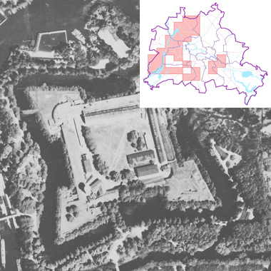
Luftbilder 1938, Maßstab 1:4 000
Senkrechtaufnahmen von Berlin um 1938, Fotoblätter ohne Überlappungen im Maßstab 1:4000.
Simple
- Date (Creation)
- 1938-01-01
- Identifier
- https://registry.gdi-de.org/id/de.be.csw/df599b88-aaf1-33f7-aab6-f538dd8e0939
- Maintenance and update frequency
- As needed
- Theme
-
-
open data
-
opendata
-
Karten
-
Sachdaten
-
Geodaten
-
Berlin
-
AdVMIS
-
Luftbilder
-
Luftbildpläne
-
Senkrechtaufnahmen
-
Luftbildplan
-
- Access constraints
- Other restrictions
- Other constraints
- Es gelten keine Zugriffsbeschränkungen
- Use constraints
- Other restrictions
- Other constraints
-
Für die Nutzung der Daten ist die Datenlizenz Deutschland - Zero - Version 2.0 anzuwenden. Die Lizenz ist über https://www.govdata.de/dl-de/zero-2-0 abrufbar.
- Other constraints
-
{"id":"dl-zero-de/2.0","name":"Datenlizenz Deutschland - Zero - Version 2.0","url":" https://www.govdata.de/dl-de/zero-2-0"}
- Spatial representation type
- Grid
- Denominator
- 4000
- Metadata language
- Deutsch
- Character set
- UTF8
- Topic category
-
- Imagery base maps earth cover
))
- Extent type code
- Yes
- Geographic identifier
- 110000000000
- Reference system identifier
- http://www.opengis.net/def/crs/EPSG/0/25833
- Distribution format
-
-
Text/HTML
(
4.01
)
- Specification
-
Keine Angabe
-
Text/HTML
(
4.01
)
- OnLine resource
- Darstellungsdienst - Luftbilder 1938, Maßstab 1:4 000 (WMS) ( Darstellungsdienst - Luftbilder 1938, Maßstab 1:4 000 (WMS) )
- OnLine resource
- Downloaddienst - Luftbilder 1938, Maßstab 1:4 000 (WFS) ( Downloaddienst - Luftbilder 1938, Maßstab 1:4 000 (WFS) )
- OnLine resource
- Inhaltliche Beschreibung
- Hierarchy level
- Dataset
- Statement
-
Daten aus der Berliner Verwaltung
- Description
-
Daten aus der Berliner Verwaltung
- File identifier
- 4893a516-4862-300f-9f6e-b0a60386c7f1 XML
- Metadata language
- Deutsch
- Character set
- UTF8
- Hierarchy level
- Dataset
- Date stamp
- 2025-11-19T00:00:00Z
- Metadata standard name
-
ISO 19115/19119 - BE
- Metadata standard version
-
1.0.0
Overviews
Spatial extent
Provided by
