 Geodatensuche Berlin
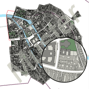
Berlin um 1900 (AISBer)
Digitalisierte (vektorisierte) Darstellung der inneren Stadt 1899-1913 des Archäologischen Informationssystems Berlin (AISBer).
Simple
- Date (Creation)
- 2010-08-25
- Date (Publication)
- 2010-08-25
- Identifier
- https://registry.gdi-de.org/id/de.be.csw/93142b3b-5346-3d5b-a52e-bd32de85f75c
- Maintenance and update frequency
- As needed
- Theme
-
-
open data
-
opendata
-
Karten
-
Sachdaten
-
Geodaten
-
Berlin
-
Stadtentwicklung
-
Städtebau
-
Historische Karten
-
AISBer
-
Archäologie
-
- Access constraints
- Other restrictions
- Other constraints
- Es gelten keine Zugriffsbeschränkungen
- Use constraints
- Other restrictions
- Other constraints
-
Für die Nutzung der Daten ist die Datenlizenz Deutschland - Zero - Version 2.0 anzuwenden. Die Lizenz ist über https://www.govdata.de/dl-de/zero-2-0 abrufbar.
- Other constraints
-
{"id":"dl-zero-de/2.0","name":"Datenlizenz Deutschland - Zero - Version 2.0","url":" https://www.govdata.de/dl-de/zero-2-0"}
- Spatial representation type
- Vector
- Denominator
- 1000
- Metadata language
- Deutsch
- Character set
- UTF8
- Topic category
-
- Planning cadastre
))
- Extent type code
- Yes
- Geographic identifier
- 110000000000
- Reference system identifier
- http://www.opengis.net/def/crs/EPSG/0/25833
- Distribution format
-
-
Text/HTML
(
4.01
)
- Specification
-
Keine Angabe
-
Text/HTML
(
4.01
)
- OnLine resource
- Darstellungsdienst - Berlin um 1900 (AISBer) (WMS) ( Darstellungsdienst - Berlin um 1900 (AISBer) (WMS) )
- OnLine resource
- Downloaddienst - Berlin um 1900 (AISBer) (WFS) ( Downloaddienst - Berlin um 1900 (AISBer) (WFS) )
- OnLine resource
- Inhaltliche Beschreibung
- OnLine resource
- Archäologisches Informationssystem Berlin (AISBer)
- Hierarchy level
- Dataset
- Statement
-
Scans von 12 analogen Kartenblättern
- Description
-
Scans von 12 analogen Kartenblättern
- File identifier
- 471639df-22cd-3b97-b205-64e6fe4253c7 XML
- Metadata language
- Deutsch
- Character set
- UTF8
- Hierarchy level
- Dataset
- Date stamp
- 2026-07-06T10:14:42.530804727Z
- Metadata standard name
-
ISO 19115/19119 - BE
- Metadata standard version
-
1.0.0
Overviews
Spatial extent
Provided by
