 Geodatensuche Berlin
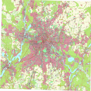
Digitale Topographische Karte 1: 25 000 (DTK25)
Das Landeskartenwerk Digitale Topographische Karte 1:25 000 visualisiert die amtlichen Geobasisdaten ATKIS und ALKIS-Gebäude im bundeseinheitlichen Regelblattschnitt. Die Ebene "Blattschnitt DTK25" enthält Informationen zur Aktualität der einzelnen Kartenblätter.
Simple
- Date (Creation)
- 2007-12-31
- Date (Publication)
- 2026-01-12
- Date (Revision)
- 2026-01-06
- Identifier
- https://registry.gdi-de.org/id/de.be.csw/4903dcb7-b77e-3f16-a617-c8de9a11e6ce
- Maintenance and update frequency
- Not planned
- Theme
-
-
open data
-
opendata
-
Sachdaten
-
Karten
-
Geodaten
-
Berlin
-
AdVMIS
-
Topographisch-Kartographisches Informationssystem
-
Amtliches Topografisch-Kartographisches Informationssystem
-
ATKIS
-
Digitale Topographische Karte 1:25 000
-
Digitale Topografische Karte 1:25 000
-
DTK
-
DTK25
-
Digitale Topografische Karte
-
Digitale Topographische Karte
-
Digitale Topografische Karten
-
Digitale Topographische Karten
-
- Access constraints
- Other restrictions
- Other constraints
- Es gelten keine Zugriffsbeschränkungen
- Use constraints
- Other restrictions
- Other constraints
-
Für die Nutzung der Daten ist die Datenlizenz Deutschland - Zero - Version 2.0 anzuwenden. Die Lizenz ist über https://www.govdata.de/dl-de/zero-2-0 abrufbar.
- Other constraints
-
{"id":"dl-zero-de/2.0","name":"Datenlizenz Deutschland - Zero - Version 2.0","url":" https://www.govdata.de/dl-de/zero-2-0"}
- Spatial representation type
- Grid
- Denominator
- 25000
- Metadata language
- Deutsch
- Character set
- UTF8
- Topic category
-
- Imagery base maps earth cover
))
- Extent type code
- Yes
- Geographic identifier
- 110000000000
- Reference system identifier
- http://www.opengis.net/def/crs/EPSG/0/25833
- Distribution format
-
-
Text/HTML
(
4.01
)
- Specification
-
Keine Angabe
-
Text/HTML
(
4.01
)
- OnLine resource
- Downloaddienst - Digitale Topographische Karte 1: 25 000 (DTK25) (ATOM) ( INSPIRE ATOM )
- OnLine resource
- Darstellungsdienst - Digitale Topographische Karte 1: 25 000 (DTK25) (WMS) ( Darstellungsdienst - Digitale Topographische Karte 1: 25 000 (DTK25) (WMS) )
- OnLine resource
- Inhaltliche Beschreibung
- Hierarchy level
- Dataset
- Statement
-
ATKIS Basis-DLM, ATKIS-Gebäude, ATKIS Basis-DLM, ALKIS-Gebäude
- Description
-
ATKIS Basis-DLM, ATKIS-Gebäude
- Description
-
ATKIS Basis-DLM
- Description
-
ALKIS-Gebäude
- File identifier
- 1e13d718-13e7-3162-8422-ff26578da7db XML
- Metadata language
- Deutsch
- Character set
- UTF8
- Hierarchy level
- Dataset
- Date stamp
- 2026-05-08T04:28:01.034029441Z
- Metadata standard name
-
ISO 19115/19119 - BE
- Metadata standard version
-
1.0.0
Overviews
Spatial extent
Provided by
