 Geodatensuche Berlin
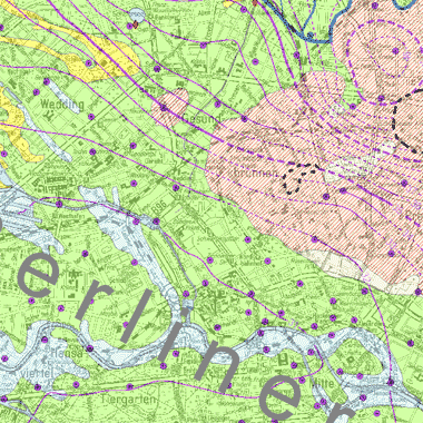
Grundwassergleichen 2017 (Umweltatlas)
Grundwassergleichenkarte des Hauptgrundwasserleiters und des Panketalgrundwasserleiters für den Mai 2017
Simple
- Date (Creation)
- 2017-12-15
- Date (Publication)
- 2018-03-06
- Identifier
- https://registry.gdi-de.org/id/de.be.csw/611f9bcc-67cc-3926-9d57-9f1098ea6f4c
- Maintenance and update frequency
- Not planned
- Theme
-
-
open data
-
opendata
-
Karten
-
Sachdaten
-
Geodaten
-
Berlin
-
Grundwasserstände
-
Grundwasserstand
-
Grundwasserganglinien
-
Grundwasserhöhenlinien
-
Hauptgrundwasserleiter
-
Panketalgrundwasserleiter
-
- Access constraints
- Other restrictions
- Other constraints
- Es gelten keine Zugriffsbeschränkungen
- Use constraints
- Other restrictions
- Other constraints
-
Für die Nutzung der Daten ist die Datenlizenz Deutschland - Zero - Version 2.0 anzuwenden. Die Lizenz ist über https://www.govdata.de/dl-de/zero-2-0 abrufbar.
- Other constraints
-
{"id":"dl-zero-de/2.0","name":"Datenlizenz Deutschland - Zero - Version 2.0","url":" https://www.govdata.de/dl-de/zero-2-0"}
- Spatial representation type
- Vector
- Spatial representation type
- Text, table
- Denominator
- 50000
- Metadata language
- Deutsch
- Character set
- UTF8
- Topic category
-
- Geoscientific information
))
- Extent type code
- Yes
- Geographic identifier
- 110000000000
- Reference system identifier
- http://www.opengis.net/def/crs/EPSG/0/25833
- Distribution format
-
-
Text/HTML
(
4.01
)
- Specification
-
Keine Angabe
-
Text/HTML
(
4.01
)
- OnLine resource
- Darstellungsdienst - Grundwassergleichen 2017 (Umweltatlas) (WMS) ( Darstellungsdienst - Grundwassergleichen 2017 (Umweltatlas) (WMS) )
- OnLine resource
- Downloaddienst - Grundwassergleichen 2017 (Umweltatlas) (WFS) ( Downloaddienst - Grundwassergleichen 2017 (Umweltatlas) (WFS) )
- OnLine resource
- Inhaltliche Beschreibung
- OnLine resource
- Technische Beschreibung
- OnLine resource
- Umweltatlas, Karte 02.12
- Hierarchy level
- Dataset
- Statement
-
2.298 Grundwassermesswerte und 139 Oberflächenwassermesswerte aus den Messnetzen des Landesgrundwasserdienstes Berlin, der Berliner Wasserbetriebe, der Wasserwerke in Brandenburg und des Landesamts für Umwelt, Gesundheit und Verbraucherschutz Brandenburg vom Mai 2017
- Description
-
2.298 Grundwassermesswerte und 139 Oberflächenwassermesswerte aus den Messnetzen des Landesgrundwasserdienstes Berlin, der Berliner Wasserbetriebe, der Wasserwerke in Brandenburg und des Landesamts für Umwelt, Gesundheit und Verbraucherschutz Brandenburg vom Mai 2017
- File identifier
- 09ee63d6-4214-3ae6-9f48-b78bdcfaa1ae XML
- Metadata language
- Deutsch
- Character set
- UTF8
- Hierarchy level
- Dataset
- Date stamp
- 2026-05-27T07:05:04.304886388Z
- Metadata standard name
-
ISO 19115/19119 - BE
- Metadata standard version
-
1.0.0
Overviews
Spatial extent
Provided by
