 Geodatensuche Berlin
Förderkulisse Zukunftsinitiative Stadtteil II; ZIS II 2014-2020
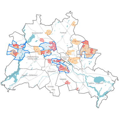
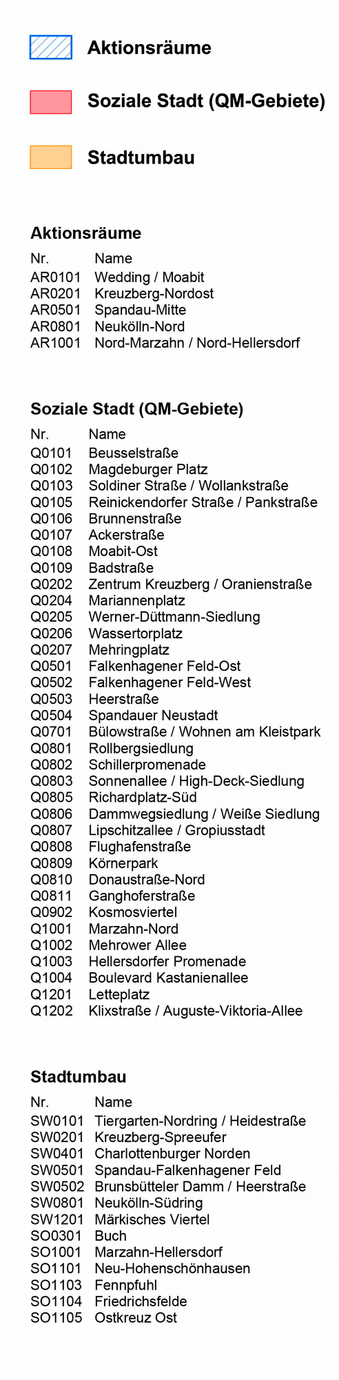
Fördergebiete 2014-2020 der Zukunftsinitiative Stadtteil II (ZIS II); integrierte Strategien zur Aufwertung von Quartieren gefördert aus Mitteln des Landes, des Bundes und der EU in Stadtumbaugebieten, Quartiersmanagementgebieten und Aktionsräumen
Simple
Identification info
- Date (Creation)
- 2014-11-28
- Date (Revision)
- 2017-09-13
- Identifier
- https://registry.gdi-de.org/id/de.be.csw/84a48784-012c-32ba-9ee4-ffc2d10e2708
- Presentation form
- Digital map
- Maintenance and update frequency
- As needed
- Theme
-
-
open data
-
opendata
-
Karten
-
Sachdaten
-
Geodaten
-
Berlin
-
EFRE
-
ZIS
-
ZIS II
-
Förderkulisse
-
Strukturfonds
-
Zukunftsinitiative
-
Stadtteil
-
- Keywords
-
-
infoMapAccessService
-
- Access constraints
- Other restrictions
- Other constraints
- Es gelten keine Zugriffsbeschränkungen
- Use constraints
- Other restrictions
- Other constraints
-
Für die Nutzung der Daten ist die Datenlizenz Deutschland - Zero - Version 2.0 anzuwenden. Die Lizenz ist über https://www.govdata.de/dl-de/zero-2-0 abrufbar.
- Other constraints
-
{"id":"dl-zero-de/2.0","name":"Datenlizenz Deutschland - Zero - Version 2.0","url":" https://www.govdata.de/dl-de/zero-2-0"}
- Service Type
- view
- Service Version
-
OGC:WMS 1.0.0
- Service Version
-
OGC:WMS 1.1.0
- Service Version
-
OGC:WMS 1.1.1
- Service Version
-
OGC:WMS 1.3.0
))
- Extent type code
- Yes
- Geographic identifier
- 110000000000
- Begin date
- 2017-09-13T00:00:00Z
- Coupling Type
- Tight
Contains Operations
- Operation Name
-
GetCapabilities
- Distributed Computing Platforms
- Web services
- Connect Point
- https://gdi.berlin.de/services/wms/zis_2_2014_2020
- Operates On
- Reference system identifier
- http://www.opengis.net/def/crs/EPSG/0/25833
- Distribution format
-
-
Text/HTML
(
4.01
)
- Specification
-
Keine Angabe
-
Text/HTML
(
4.01
)
- OnLine resource
- Darstellungsdienst - Förderkulisse Zukunftsinitiative Stadtteil II; ZIS II 2014-2020 (WMS) ( Darstellungsdienst - Förderkulisse Zukunftsinitiative Stadtteil II; ZIS II 2014-2020 (WMS) )
- OnLine resource
- Darstellung der Karte im Geoportal Berlin
- Hierarchy level
- Service
- Other
-
Dienst
- File identifier
- 241b2298-a6b2-3496-8493-410512d7dae6 XML
- Metadata language
- Deutsch
- Character set
- UTF8
- Hierarchy level
- Service
- Hierarchy level name
-
Förderkulisse Zukunftsinitiative Stadtteil II; ZIS II 2014-2020 Dienst
- Date stamp
- 2025-11-19T00:00:00Z
- Metadata standard name
-
ISO 19115/19119 - BE
- Metadata standard version
-
1.0.0
Overviews
Spatial extent
Provided by